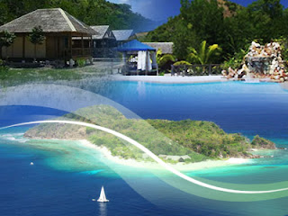
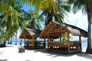
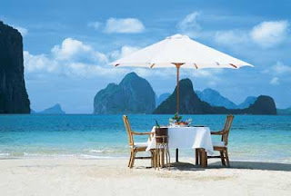
Palawan is an island province of the Philippines located in the MIMAROPA region or Region 4. Its capital is Puerto Princesa City, and it is the largest province in the country in terms of total area of jurisdiction. The islands of Palawan stretch from Mindoro in the northeast to Borneo in the southwest. It lies between the South China Sea and the Sulu Sea. The province is named after its largest island, Palawan Island (09°30′N 118°30′E), measuring 450 kilometres (280 mi) long, and 50 kilometres (31 mi) wide. Palawan is composed of the long and narrow Palawan Island, plus a number of other smaller islands surrounding the main island. The Calamianes Group of Islands, to the northeast consists of Busuanga Island, Culion Island, and Coron Island. Durangan Island almost touches the westernmost part of Palawan Island, while Balabac Island is located off the southern tip, separated from Borneo by the Balabac Strait. In addition, Palawan covers the Cuyo Islands in the Sulu Sea. The disputed Spratly Islands, located a few hundred kilometres to the west is considered part of Palawan by the Philippines, and is locally called the Kalayaan Group of Islands.
The history of Palawan may be traced back 22,000 years ago, as confirmed by the discovery of bone fragments of the Tabon Man in the municipality of Quezon. Although the origin of the cave dwellers is not yet established, anthropologists believe they came from Borneo. Known as the Cradle of Philippine Civilization, the Tabon Caves consist of a series of chambers where scholars and anthropologists discovered the remains of the Tabon Man along with his tools and a number of artifacts.
These are the most popular tourism,worlds best tourism places. Here not just information about best tourism places of the world along with route to visit with cheap expenses.
Sunday, May 20, 2012
Palawan Philippines Beautiful Beaches
Saturday, May 19, 2012
Hong Kong Ocean Park Tourism A Place For Everyone
Opened on 10 January 1977 by the Governor of Hong Kong, Sir Murray MacLehose. Ocean Park was constructed with HK$150 million funded by The Hong Kong Jockey Club. The land was provided free by the Hong Kong Government. Between 1982 and 1984, The Hong Kong Jockey Club allocated a further HK$240 million into developing facilities at Tai Shue Wan and thrill rides at the Summit. Ocean Park ceased to be a subsidiary of the Hong Kong Jockey Club on 1 July 1987, becoming its own statutory body, with a Government-appointed Board. The Hong Kong Jockey Club established a HK$200 million trust to ensure the Park’s continued development. At present, Ocean Park is managed by the Ocean Park Corporation, a financially independent, non-profit organisation.
Tuesday, May 15, 2012
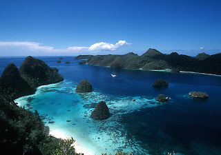
Travel to Raja Ampat West Papua in Indonesia
Located off the northwest tip of Bird's Head Peninsula on the island of New Guinea, in Indonesia's West Papua province, Raja Ampat, or the Four Kings, is an archipelago comprising over 1,500 small islands, cays, and shoals surrounding the four main islands of Misool, Salawati, Batanta, and Waigeo, and the smaller island of Kofiau. Raja Ampat Regency is a new regency which separated from Sorong Regency in 2004. It encompasses more than 40,000 km² of land and sea, which also contains Cenderawasih Bay, the largest marine national park in Indonesia. It is a part of the newly named West Papua (province) of Indonesia which was formerly Irian Jaya. The islands are the most northern pieces of land in the Australian continent.
The name of Raja Ampat comes from local mythology that tells about a woman who finds seven eggs. Four of the seven eggs hatch and become kings that occupy four of Raja Ampat biggest islands whilst the other three become a ghost, a woman, and a stone. History shows that Raja Ampat was once a part of Tidore Kingdom, an influential kingdom from Maluku. Yet, after Holland invaded Maluku, it was shortly claimed as a part of the kingdom of Holland. The main occupation for people around this area is fishing since the area is dominated by the sea. They live in a small colony of tribes that spreads around the area. Although traditional culture still strongly exists, they are very welcoming to visitors. Their religion is dominantly Christian.
The name of Raja Ampat comes from local mythology that tells about a woman who finds seven eggs. Four of the seven eggs hatch and become kings that occupy four of Raja Ampat biggest islands whilst the other three become a ghost, a woman, and a stone. History shows that Raja Ampat was once a part of Tidore Kingdom, an influential kingdom from Maluku. Yet, after Holland invaded Maluku, it was shortly claimed as a part of the kingdom of Holland. The main occupation for people around this area is fishing since the area is dominated by the sea. They live in a small colony of tribes that spreads around the area. Although traditional culture still strongly exists, they are very welcoming to visitors. Their religion is dominantly Christian.
Visit To Switzerland Zurich :)
Zürich is a city whose reputation precedes it - and does it a complete disservice, trashes its name, gives it a good kicking. A boring banking capital? 'Zu Reich' (too rich), business-minded and uptight? The spotless Singapore of Europe? If Switzerland's largest metropolis once lived down to those dull descriptions, it certainly no longer does. Contemporary Zürich might still be home to the world's fourth-biggest stock exchange and remain Switzerland's financial engine, but it's also (whisper it softly) surprisingly vibrant and trendy. Located on a picturesque river and lake whose water you can drink, easy to get around and a stranger to the hassled lifestyle that defines bigger cities, this affluent, fashion-conscious place enjoys the finest things in life. Hundreds of new bars, restaurants and clubs have opened since the late 1990s and, since its Street Parade overtook London's Notting Hill Carnival, Zürich now hosts Europe's largest annual street party. Its former industrial quarter brims with nightlife venues catering to a youngish crowd, and this happening 'Züri-West' district has the same buzz as Berlin's Prenzlauerberg or Mitte. The infamous 'gnomes', as the British like to call Zürich's bankers, are still here, but sometimes they can astonish you by whizzing by on a Segway scooter. Fortunately, the city's Protestant modesty saves it from ever becoming too schmicki-micki (chi-chi). With church steeples rising against a backdrop of hills and mountains, the medieval old town will also appeal to traditionalists.
Monday, May 14, 2012
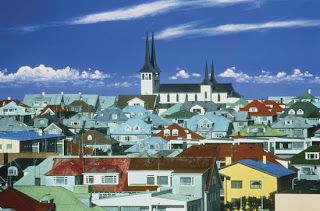
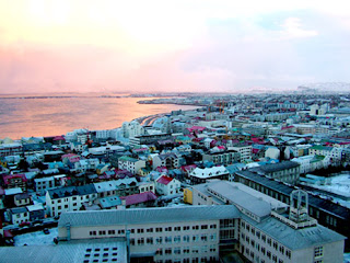
Reykjavik Tourism The Coldest Place In Earth
Reykjavík is located in southwest Iceland. The Reykjavík area coastline is characterized by peninsulas, coves, straits, and islands. During the Ice Age (up to 10,000 years ago) a large glacier covered parts of the city area, reaching as far out as Álftanes. Other parts of the city area were covered by sea water. In the warm periods and at the end of the Ice Age, some hills like Öskjuhlíð were islands. The former sea level is indicated by sediments (with clams) reaching (at Öskjuhlíð, for example) as far as 43 m (141.08 ft) above the current sea level. The hills of Öskjuhlíð and Skólavörðuholt appear to be the remains of former shield volcanoes which were active during the warm periods of the Ice Age. After the Ice Age, the land rose as the heavy load of the glaciers fell away, and began to look as it does today. But the capital city area continued to be shaped by earthquakes and volcanic eruptions, like the one 4500 years ago in the mountain range Bláfjöll, when the lava coming down the Elliðaá valley reached the sea at the bay of Elliðavogur. The largest river to run through Reykjavík is the Elliðaá River, which is non-navigable. It is one of the best salmon fishing rivers in the country. Mt. Esja, at 914 m (2,998.69 ft), is the highest mountain in the vicinity of Reykjavík.
The city of Reykjavík is mostly located on the Seltjarnarnes peninsula, but the suburbs reach far out to the south and east. Reykjavík is a spread-out city; most of its urban area is in the form of low-density suburbs, and houses are usually widely spaced. The outer residential neighborhoods are also widely spaced from each other; in between them run the main traffic arteries and a lot of empty space.
The city of Reykjavík is mostly located on the Seltjarnarnes peninsula, but the suburbs reach far out to the south and east. Reykjavík is a spread-out city; most of its urban area is in the form of low-density suburbs, and houses are usually widely spaced. The outer residential neighborhoods are also widely spaced from each other; in between them run the main traffic arteries and a lot of empty space.
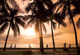
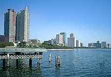
Manila Tourism Life in Manila :)
Manila is the capital of the Philippines, the center of governance, education, religion and finance in the country. Industrial air, concrete jungle, congested roads and polluted streets are might be the first impression of Manila but don't let that stop you for exploring more, its churches, diverse and complicated culture, Spanish colonial trademarks, gigantic malls, vibrant nightlife gives everyone the opportunity not only to explore Manila but to have a personal connection with the city.
Subscribe to:
Comments (Atom)


