Thursday, March 31, 2011

The Grand Canyon in United States


A steep gorge by the Colorado River, Arizona in the United States, the Grand Canyon has some truly enjoyable scenery. It is 277 miles in length, 4 to 18 miles in width, and about a mile deep. Scientists believe that the canyon was created by the Colorado River over a six million year period. Native Americans built settlements in the caves within the canyon before the emigration of Europeans. It was also considered to be a site of pilgrimage by the Pueblo people. The first recorded visit to the Grand Canyon by the Europeans was in 1869.


Although it is not the deepest canyon in the world, it is known for its extremely large size and beautifully intricate landscape. The Grand Canyon National Park is said to be one of the first national parks in the United States and it attracts more than five million visitors a year. Weather conditions in the Grand Canyon vary greatly between seasons as well as varying at different elevations. While winter snow is experienced by the higher forested rims, the inner gorge has a desert temperature because of the low elevation.

Wednesday, March 30, 2011

Canadian Rockies in Canada


Canadian Rockies comprise the Canadian segment of the North American Rocky Mountains range. They are the eastern part of the Canadian Cordillera, extending from the Interior Plains of Alberta to the Rocky Mountain Trench of British Columbia. The southern end borders Idaho and Montana of the USA. They are a visitor’s wonderland and the playground for western Canada. They are older than the American Rockies and are formed from over thrusting. Canadian Rockies house five national parks, and four of those national parks combine to form a single UNESCO World Heritage Site that consists of beautiful mountain landscapes, lakes, canyons, waterfalls, glaciers, peaks, limestone caves, and fossils. Mount Robson is the highest peak of the Canadian Rockies and climbing it is considered a challenge. These beautiful mountains are a haven for hikers and walkers alike.

Tuesday, March 29, 2011

Great Wall of China-China


One of the seven wonders of the world, the Great Wall of China is a man-made structure that was constructed over two thousand years ago and took about 100 years to complete. The Great Wall of China, one of the greatest wonders of the world, was listed as a World Heritage by UNESCO in 1987. The vastness of this project brings to light the immense capabilities of man. Great Wall of China is a series of stone and earthen fortifications in northern China, built originally to protect the northern borders of the Chinese Empire against intrusions by various nomadic groups. Several walls have been built since the 5th century BC that are referred to collectively as the Great Wall, which has been rebuilt and maintained from the 5th century BC through the 16th century.

Monday, March 28, 2011

Empire State Building-New York


The Empire State Building is an architectural marvel, and one of the most striking attractions in New York City. The building itself was constructed during the Great Depression and is a living monument to that era and the city it so proudly illuminates. The building has starred in over 90 movies, and it remains one of New York City's most popular tourist attractions. The Empire State Building is a 102-story landmark Art Deco skyscraper in New York City, United States, at the intersection of Fifth Avenue and West 34th Street. It is 1,250 ft (381 meters) tall. Its name is derived from the nickname for New York, the Empire State. It stood as the world's tallest building for more than 40 years, from its completion in 1931 until construction of the World Trade Center's North Tower was completed in 1972. Following the destruction of the World Trade Center in 2001, the Empire State Building once again became the tallest building in New York City.
The Empire State Building has been named by the American Society of Civil Engineers as one of the Seven Wonders of the Modern World. The building and its street floor interior are designated landmarks of the New York City Landmarks Preservation Commission, and confirmed by the New York City Board of Estimate. It was designated as a National Historic Landmark in 1986. In 2007, it was ranked number one on the List of America's Favorite Architecture according to the AIA. The building is owned and managed by W&H Properties. The Empire State Building is currently the third tallest skyscraper in the United States, and the 15th tallest in the world. It is also the fourth tallest freestanding structure in the Americas. The Empire State Building is currently undergoing a $550 million renovation, with $120 million utilized in an effort to transform the building into a more energy efficient and eco-friendly structure.

Sunday, March 27, 2011

Christ Redeemer-Brazil


Christ the Redeemer is a statue of Jesus Christ in Rio de Janeiro, Brazil; considered the second largest Art Deco statue in the world. It is 39.6 metres (130 ft) tall, including its 9.5 metres (31 ft) pedestal, and 30 metres (98 ft) wide. It weighs 635 tonnes, and is located at the peak of the 700-metre (2,300 ft) Corcovado mountain in the Tijuca Forest National Park overlooking the city.

In Portugese, this iconic monument is known as Cristo Redentor. The original design of the Christ the Redeemer statue was born by a man named Oswald. He designed it to have a globe in one hand and stand over a pedestal symbolizing the world but the design was not agreed upon. Another proposal for a monument was prepared and made in 1921 by the archdiocese of Rio de Janeiro. He organized an event named Seman de Monumento ("Monument Week") in hopes of attracting donations, which were attained mainly by Brazilian Catholics who readily awaited a design decision for an effigy. On 7 July 2007, Christ the Redeemer was named one of the New Seven Wonders of the World in a list compiled by the Swiss-based The New Open World Corporation

Friday, March 25, 2011

Mount Blanc-France


Mount Blanc is one of the classic alpine routes and world’s most famed walks. It circles the highest mountain in western Europe and many of its satellite peaks, passing through France, Switzerland and Italy - three contrasting countries which share the Mont Blanc Massif between them. Although demanding in parts, the trail is well within the capabilities of any fit mountain walker, involving generally moderate hiking through delightful alpine villages and picturesque valleys. Our route crosses from country to country over high mountain passes, and in addition to the stunning mountain scenery on offer we will be able to savour the food and wines of this region in a variety of traditional alpine inns.

The complete circuit of Mont Blanc covers just over 100 miles and circumnavigates the massif via a series of high passes. Each one of these opens up a new vista into the seven major valleys which drain the spectacular glaciers of the range. Mont Blanc (4807m) is the highest mountain in the range and its huge aspect totally dominates the view from wherever you are on the walk. But we also see other famous alpine peaks including the famous Chamonix Needles - the Dru, the Grepon and the Grands Charmoz - steep pinnacles of rock which attracted many of the early British alpinists. Our trek culminates with a spectacular traverse of the ‘Grand Balcon’ - a delightful elevated terrace which runs on the opposite side of the valley to the Mont Blanc Massif and which provides the classic panoramic views of the range including the much-photographed reflection in the still waters of Lac Blanc. On the final day of our trek we may be able to make an ascent of the Brevent (2312m), before finally descending to the Chamonix Valley where we can celebrate our successful circumnavigation of this classic peak.

Wednesday, March 23, 2011

Brazil-Most Famous Tourist place


Brazil is a most famous tourist place. this is the first choice to spend holdays. Brasilia is the largest city and the capital of the nation it is also the center of all major political and cultural activities within the country. Some of the major cities in Brazil include Brasilia, Sao Paulo, Rio de Janeiro, Salvador, Fortaleza, Belo Horizonte, Curitiba and Manaus. satisfying the needs of thousands of visitors visiting Brazil every year. Sao Paulo, Brasilia and Rio de Janeiro are the cities hosting the busiest airports in Brazil. Serving for many international airlines and dealing with flights to Brazil from many destinations in the world and from Brazil to different other parts of the world. Tourism industry plays a vital role in the economy of Brazil and the tourism department of the country has shown great progress by developing new and improving old highways, roads and development of transportation including renovation of many of the airports and accessibility of better facilities.

Tuesday, March 22, 2011

Munnar in Kerala


Munnar is the famous tourist attraction in Kerala. This is one of the most popular hill-resort towns in kerala, also called as Kashmir of South India. Munnar means "Three Rivers". It is one of the world's highest tea growing estates. Munnar also has the highest peak in South India Anamudi, at 2695 m.

Taj Mahal in India


Taj Mahal in India is one of the wonders of the world and is one of the most beautiful mausoleums constructed by the Mughal emperor, Shah Jahan, in memory of his favorite queen, Mumtaz Mahal. Located in Agra, white marble was used in the construction of this symbol of love, and the Taj Mahal is considered to be the pinnacle of Mughal architecture.emperor was grief-stricken when he lost his beloved third wife, Mumtaz Mahal. Semi-precious stones were used for inlay ornamentation. It later became the mausoleum of Shah Jahan too. This is a huge tourist attraction with one to two million tourists visiting it every year.

Sunday, March 20, 2011

Umang Island Resort Travel World


Umang Island Resort Travel World
When you have free time, occasionally we can vacation in Umang Island. This island is a small island located in the Gulf of Wells, West Java, Banten, Pandeglang. These attractions provide a variety of water sports. Among snorkeling, jet skiing and banana boat. The waters around Pulau Umang safe enough for a variety of water sports is because the waves around the island are relatively quiet. This is due to the location of the island that is not directly facing the open sea, but blocked by the Ujung Kulon. And DII addition, Umang Island is also very close to the mainland.

Beauty Hilton Malvides Island Resort Travel World


Beauty Hilton Malvides Island Resort Travel World
Hilton Maldives Resort combines 3 luxury resorts on two islands and is surrounded by a coral reef and lagoon. It is winner of the “Best Resort in the Indian Ocean” at the 2004 World Travel Awards and runner up for “Best Resort in the World” in Business Traveler Magazine, the resort is renowned for attentive service and fine cuisine along with an abundance of leisure facilities.

The ultimate romantic spa getaway includes a luxurious stay for two in a Spa Water Villa, daily breakfast, one 55 minute massage per villa per day, one 30 minute session in a private steam

Beauty Beach Batam Island Resort


Beauty Beach Batam Island Resort
Batam View Beach Resort Batam Island: Built exclusively atop a hill with access to a private beach.

Cool Tangalooma Island Resort Travel World


Cool Tangalooma Island Resort Travel World

Tourism on the Island of Madura Island Resort


Tourism on the Island of Madura Island Resort
AS barren island of Madura and the heat is not true. Because, when traced, turned out the biggest island in East Java has the potential for a fascinating tour. One is the 'Island of Salt' located in Sumenep. This area has a variety of tourist attractions, beaches and islands khususnyai beautiful.

Rows of islands in the eastern island of Madura basin berbanjar dancing girl is called Kangean Islands. The nickname is because most large island row is Kangean. In addition, there's more Sapudi Island, Raas, Puteran, tiles, Iyang Gili, and King Island. Sumenep Government calls the islands the region as a tourist attraction Island Resort. Tourist attraction that offers crystal clear blue sea, the curve of the beach and coral reefs are already dead into the rock, and a soothing silence.

Underwater Beauty of Cape Dimples Travel World


Underwater Beauty of Cape Dimples Travel World
Dimples Cape is one of the most attractive tourist beach in Banten Province. This area offers views of blue sea and directly to the children of Mount Krakatoa. In the tourist area covering 1500 ha, you can enjoy the nature that are still beautiful, very clean sea water, fresh air that makes you come back fresh after the five-day work with great fatigue.

"To feel the water is very clean, we provide an area called the Beach Club there are few facilities for guests to try it," he said. Various facilities provided at the Beach Club. Starting from Snorkeling, Banana Boat, Glass bottomed boat, Water Polo, jetski, Wind Surfing, Sailing, diving, and many others.

Saturday, March 19, 2011

Mui Ne Beach Most Popular Vietnam Tour and Fisher

MUI NE Beach is Vietnam’s largest and fastest-growing resort community. Until the solar eclipse of 1995 when thousands flocked to the area for the best glimpse, Mui Ne remained a relatively unknown fishing community hidden in the palm groves along the beach, reachable only by a primitive dirt road. Since then it has become one of the top beach get-a-ways in Vietnam, as well as the water sports capital of the country. November through March is windy season, and during this period the bay is crowded with kite boarders and wind surfers from around the globe.

Mui Ne Beach

Mui Ne Beach and the surrounding Binh Thuan province have everything to offer. We have beautiful tropical beaches lined with groves of swaying palm trees; immense saharan sand dunes meandering for kilometers through colors of red, yellow and white. We have winding rivers teeming with fresh fish and crabs; tall mountains with bamboo rainforests and pristine waterfalls. There are deep red canyons parted by twisting streams and echoed by the sounds of tropical birds.

Mui Ne Beach Fantastic red and white sand dunes, which can be explored on a jeep tour (most often includes a sand-sledding session), are a must-see. Another destination worth a visit is the so called Fairy Stream, a scenic creek winding through breathtaking red and white sand cliffs from deep in the dunes out to the beach. Here you should take your time (around 2 hours) to walk bare-foot through the shallow water and admire the wonderful natural surroundings.

Mui Ne Beach

Set in front of beautiful red sand dunes, Mui Ne Beach offers more than 16 kilometres of once pristine coastline, which has been developed over the last years with accommodation offering everything from budget on-the-beach bungalows to high-end hotels on at the beach, as well as restaurants and souvenirs shops. The fishing village is still there and marks the eastern end of the beach. Strong sea breezes and a hot and dry climate make Mủi Né very popular for kite- and windsurfing though people looking for nightlife may have to go to Phan Thiet, which is only 15 kilometres away.

Mui Ne sees only about half the rainfall of nearby PhanThiet. The sand dunes help protect its unique microclimate, and even during the wet season (from June to September) rains tend to be fairly light and sporadic. Mui Ne's developing a reputation as the action capital of the coast. There's no scuba diving or snorkelling to speak of, but when Nha Trang and Hoi An get the rains, Mui Ne gets the waves. Surfs up from August to December. For windsurfers, the gales howl as well, especially from late October to late April, when swells stir over from the Philippine ty-phoons.

Binh Thuan provinc and Phan Thiet Water Tower Vietnam Tourism

Welcome to Binh Thuan Province, an area like nowhere else in Vietnam. Visitors often pass through Binh Thuan on Highway 1, as they travel between Ho Chi Minh City and Nha Trang, stopping along the way in the beach resort hotspot of Mui Ne. Mui Ne is known for its lazy groves of palm trees lining long stretches of quiet beachfront. A reliable coastal breeze and equally reliable sunny weather have also made Mui Ne the water sports capitol of Vietnam.

There’s more to Binh Thuan than pleasant beaches however. The province contains South East Asia’s only desert region, with vast Saharan dunes, cactus and boulder-strewn mountains. Binh Thuan receives the lowest rainfall in all of Vietnam. Still, the northern mountains of Binh Thuan support dense tropical rainforests with diverse ecosystems. The local cultures are no less varied, with numerous minorities living in the mountains and desert plains. The ancient Champa kingdom made its southernmost outpost with towers that still overlook Phan Thiet city, the provincial capital.

Phan Thiet Water Tower

The descendants of this matriarchal culture with its mixture of Hinduism, Buddhism, Islam and unique indigenous beliefs still live in villages along the coast. Binh Thuan has been prominent in modern and French colonial history, with several important military outposts located around Phan Thiet. Ho Chi Minh himself made Phan Thiet his home for a brief time, while he taught at a local school before his days as a revolutionary leader.

For those who are tired of the hectic tourist track through South East Asia, it’s common to come to the area planning to spend just a few days, and end up remaining for several weeks. If you are looking for a chance to just relax and forget about the checklists of tourist sites, you are certain to enjoy your time here, no matter how long you stay.

Phan Thiet Water Tower

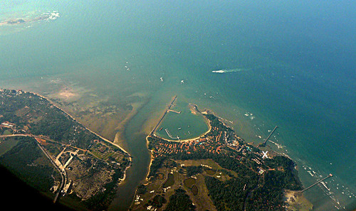
PHAN THIET is known internationally for three things: the production of nuoc mam (fish sauce), dragon fruit plantations, and tourism (centering in Mui Ne Beach). The old quarter is nestled along the banks of the Ca Ty River, but the new city has spread out for nearly 9 kilometers along the beach, nestled in a valley between mountains to the north and sandy bluffs to the east and west. At the center of town, on the East bank of the river, stands the Phan Thiet Water Tower. This elegant symbol of Binh Thuan province is incorporated in numerous local emblems. It was designed in the 1930’s by Prince Suphanouvong of Laos. Across the river is the city’s central market, which is a great place to have breakfast and pick up fresh produce.

Near the market on Trung Noi Street is the Ho Chi Minh Museum and Duc Thanh School (Tues-Sun, 7:30-11:30am & 1:30-4:30pm; small admission fee). In 1910 Ho Chi Minh taught at the school for a year, before leaving to pursue more revolutionary endeavors. The school was abandoned but later rebuilt in his honor, along with a new museum on the site of his former home. The museum contains some of his personal effects, dioramas from the revolutionary period, and some local natural history displays and wildlife specimens.

Along the riverfront you’ll find numerous vendors selling candied fruits, dried squid and peanut brittle. At Tran Hung Dao Bridge the Ca Ty River flows into the Phan Thiet harbor, with its brightly colored fishing fleet and small lighthouse beyond. This is the best place to watch celebrations of the Cau Ngu/Nghinh Ong Festival (dates depend upon the lunar calendar but may be altered by the local government, though usually the end of the summer) and Mid Autumn Festival (October 9, 2009). Cau Ngu & Nghinh Ong are a whale-worship festival with elaborate costumed parades, while the Mid Autumn Festival is a traditional Chinese festival known for evening lantern displays and eating moon cakes. Phan Thiet is nationally recognized as the best place to observe both. The riverfront is especially beautiful during evening festivities when there are elaborate fireworks shows.

Nha Trang is One of Vietnam’s Popular Beach Getaways

With its sparkling bays, coco palms, warm waters and white sand beaches, Nha Trang is one of Vietnam’s popular beach getaways. The town itself is small, with fishing as a primary industry. Fishing boats painted bright red and blue provide a splash of color to the rustic harbors. A short drive into the countryside reveals rural farming villages nestled in the verdant valleys of gently sloping mountains.

Nha Trang Beach has a rich historical past, and was formerly the center of the ancient Kingdom of Champa, The kingdom dominated the region from the 2nd century A.D. until the 15th century when they were defeated by the Ly Dynasty, founders of the independent Vietnamese state. Tower ruins of this civilization have survived the years, and are located just north of town.

Nha Trang

The Cham Towers, which represent a holy place where many come to pray, explore or relax while enjoying the views sit atop a hill overlooking the Cai River estuary. In 1891, Dr. Alexander Yersin, a French immunologist, founded Xom Bau Village where fishermen migrated, making it a bustling and crowded village. Quickly, more and more people began migrating to the new town and a local government was established. The small village, later named Nha Trang, is now the capital of the Khanh Hoa province and has a population of approximately 300,000 inhabitants.

Nha Trang

The town’s four-mile stretch of beach, with white sand and warm Caribbean-like waters, made this a popular spot for U.S. servicemen stationed here during the Vietnam war, and today attracts local
vacationers plus a handful of westerners.

Nha Trang


Nha Trang Whether exploring downtown, the countryside, or just relaxing at the beach, you’re sure to enjoy the warmth and friendliness of the people and the simple and relaxed atmosphere of this tow